Category:High Street, Fremantle
Jump to navigation
Jump to search
- West of High st
| Object location | | View all coordinates using: OpenStreetMap |
|---|
- High St mall
| Object location | | View all coordinates using: OpenStreetMap |
|---|
- East end of High st
| Object location | | View all coordinates using: OpenStreetMap |
|---|
street in Fremantle, Western Australia | |||||
| Upload media | |||||
| Instance of | |||||
|---|---|---|---|---|---|
| Location | Fremantle, City of Fremantle, Western Australia, AUS | ||||
| Connects with | |||||
| Partially coincident with |
| ||||
 | |||||
Subcategories
This category has the following 35 subcategories, out of 35 total.
3
- 33-37 High Street, Fremantle (5 F)
7
- 7 High Street, Fremantle (2 F)
8
- 82 High Street, Fremantle (2 F)
- 85-87 High Street, Fremantle (2 F)
9
- 97-99 High Street, Fremantle (4 F)
A
- Adelec Buildings, Fremantle (2 F)
- Ajax Building (3 F)
B
C
- Central Chambers (Fremantle) (3 F)
- Church of Christ, Fremantle (5 F)
- Cleopatra Hotel, Fremantle (2 F)
- Commercial Bank, Fremantle (4 F)
- Commercial Hotel, Fremantle (1 F)
D
- Dalkeith House (5 F)
F
- Fremantle Grammar School (13 F)
- Fremantle Navy Club (5 F)
- Fremantle Tramways car barn (7 F)
H
- Higham's Buildings (5 F)
- Hotel Fremantle (3 F)
L
- Lenaville (3 F)
M
- Manning Buildings (12 F)
- Marich Buildings, Fremantle (7 F)
N
- National Hotel, Fremantle (12 F)
O
- Orient Hotel, Fremantle (5 F)
- Owston's Buildings (2 F)
P
- P&O Hotel, Fremantle (7 F)
R
- RSL Club, Fremantle (1 F)
U
- Union Bank, Fremantle (1 F)
- Union Stores Building (1 F)
V
- Victoria Hall (Fremantle) (6 F)
W
Media in category "High Street, Fremantle"
The following 82 files are in this category, out of 82 total.
-
 16 High Street Fremantle.jpg 2,592 × 1,936; 1.36 MB
-
 2018-01-30 102752 Fremantle anagoria.jpg 4,032 × 2,268; 3.94 MB
-
 2nd AIF march through Fremantle.jpg 2,855 × 4,800; 1.2 MB
-
 66 High Street Fremantle.jpg 2,592 × 1,936; 1.43 MB
-
 8 and 10 High Street.jpg 2,592 × 1,936; 1.37 MB
-
 Anzac Day parade Fremantle.jpg 870 × 622; 369 KB
-
 Ardmore gnangarra-3.jpg 4,672 × 3,104; 9.66 MB
-
 Ardmore residential gnangarra-1.jpg 4,026 × 2,506; 6.52 MB
-
 Assertion of footpath ownership on High Street.jpg 4,160 × 3,120; 5.64 MB
-
 Atwell arcade gn.jpg 3,000 × 4,000; 3.44 MB
-
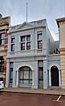 Commercial Building, 12 High Street.jpg 2,037 × 3,297; 1.51 MB
-
 Door to 51 High Street.jpg 2,252 × 4,000; 2.9 MB
-
 East Street and High Street junction.jpg 1,095 × 1,364; 472 KB
-
 Entrace to the Buffalo Club.jpg 4,000 × 3,000; 5.4 MB
-
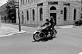 Freementle-harley.jpg 640 × 419; 55 KB
-
 Fremantle (2051672157).jpg 2,048 × 1,536; 1.35 MB
-
 Fremantle Book Stamp.jpg 654 × 449; 82 KB
-
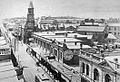
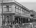
 Fremantle High Street 1906.jpg 493 × 389; 122 KB
-
 Fremantle High Street 1940s.jpg 1,040 × 642; 488 KB
-
 Fremantle map053 May 1914.jpg 6,933 × 7,979; 2.41 MB
-
 Fremantle Police Station in High Street.jpg 4,608 × 3,072; 5.09 MB
-
 Fremantle streets (3990534153).jpg 3,264 × 2,448; 2.27 MB
-
 Fremantle Town Hall High Street.jpg 1,052 × 721; 560 KB
-
 Fremantle tram Carrington.jpg 665 × 390; 169 KB
-
 Freo gnangarra-109.jpg 3,264 × 4,928; 3.05 MB
-
High St Fremantle 051121 gnangarra.webm 4 min 22 s, 1,920 × 1,080; 424.9 MB
-
 High St Fremantle gn2.jpg 3,000 × 4,000; 5.67 MB
-
 High St Fremantle, Western Australia.jpg 2,560 × 1,920; 953 KB
-
 High St mall Fremantle gn.jpg 4,000 × 3,000; 5.58 MB
-
 High Street Fremantle 1.jpg 759 × 569; 115 KB
-
 High Street Fremantle 1870.jpg 536 × 410; 110 KB
-
 High Street Fremantle 1929.jpg 631 × 410; 133 KB
-
 High Street Fremantle 2.jpg 1,024 × 768; 542 KB
-
 High Street from King Square.jpg 1,280 × 554; 387 KB
-
High Street from Market St to Roundhouse.ogv 1 min 1 s, 1,280 × 720; 61.1 MB
-
 High Street in Fremantle.jpg 3,420 × 2,747; 1.76 MB
-
 High Street north side from Cliff Street.jpg 1,280 × 708; 264 KB
-
 High Street south side from Cliff Street.jpg 1,280 × 960; 384 KB
-
 High Street Tram building and round house.jpg 1,280 × 766; 236 KB
-
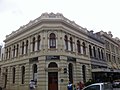
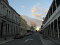
 High Street, Fremantle 01.jpg 5,184 × 3,456; 7.62 MB
-
 High Street, Fremantle 02.jpg 5,040 × 3,360; 2.79 MB
-
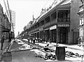
 High Street, Fremantle, looking east after dismantling.jpg 332 × 425; 35 KB
-
 High Street, Fremantle, Western Australia.jpg 4,608 × 3,456; 3.12 MB
-
 High Street, Fremantle.jpg 4,032 × 3,024; 1.19 MB
-
 Intersection of High and Cliff Streets.jpg 1,249 × 1,024; 278 KB
-
 Japingka shop sign, Fremantle.jpg 5,472 × 3,648; 10.42 MB
-
 Kim Scott monument close up.jpg 4,608 × 3,072; 4.41 MB
-
 Kim Scott monument.jpg 3,072 × 4,608; 4.76 MB
-
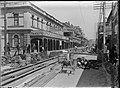
 Laying tramlines.jpg 2,700 × 2,000; 2.16 MB
-
 Little High Street.jpg 4,000 × 2,252; 2.73 MB
-
 Marich Buildings - signage.jpg 3,056 × 4,592; 4.56 MB
-
 MK-08496 High Street (Fremantle).jpg 2,048 × 2,048; 2.63 MB
-
 OIC fremantle high street mall.jpg 1,600 × 1,200; 880 KB
-
 Old "West Australian" newspaper printing works - panoramio.jpg 3,072 × 2,304; 1.41 MB
-
 Opening of Fremantle Municipal Tramways.jpg 516 × 397; 137 KB
-
 Opening of Fremantle trams.jpg 505 × 397; 120 KB
-
 Oriana Cinema, Fremantle 1950.jpg 521 × 410; 65 KB
-
 Pearse's Buildings.jpg 2,592 × 1,936; 1.56 MB
-
 Record Finder shop sign, Fremantle.jpg 5,472 × 3,648; 12.02 MB
-
 Round House, Fremantle2.jpg 2,040 × 1,188; 306 KB
-
 Tram (5322326733).jpg 1,024 × 768; 128 KB
-
 Tram tracks Fremantle 2.jpg 536 × 396; 148 KB
-
 Tram tracks Fremantle 3 (cropped for Atlas Building).jpg 3,005 × 2,375; 626 KB
-
 Tram tracks Fremantle 3.jpg 4,800 × 3,527; 1.47 MB
-
 Tram tracks Fremantle.jpg 486 × 381; 120 KB
-
 Tum Tum tree gnangarra-1.jpg 2,881 × 2,465; 3.43 MB
-
 WTF Fred Oostryck 64 High Street.jpeg 4,928 × 3,264; 6.07 MB
-
 WTF Fred Oostryck Backpackers.jpg 4,928 × 3,264; 6.02 MB
-
 WTF Fred Oostryck Buskers 2.jpg 4,928 × 3,264; 6.94 MB
-
 WTF Fred Oostryck Buskers.jpg 4,928 × 3,264; 5.98 MB
-
 WTF Fred Oostryck Dymocks bookshop.jpg 4,928 × 3,264; 7.76 MB
-
 WTF Fred Oostryck High Street books.jpeg 4,928 × 3,264; 6.44 MB
-
 WTF Fred Oostryck Man giving buskers money.jpg 4,928 × 3,264; 7.04 MB
-
 WTF Fred Oostryck Tourist taking a photo in the Mall.jpg 4,928 × 3,264; 6.47 MB
-
 WTF Jim Owens High Street from Round House.jpg 3,168 × 4,752; 4.75 MB
-
 WTF Jim Owens High Street near Round House.jpg 4,752 × 3,168; 5.25 MB
-
 WTF Josh Bluntschli Busker.jpg 4,608 × 3,072; 3.97 MB
-
 WTF Josh Bluntschli Child.jpg 4,608 × 3,072; 3.4 MB
-
 WTF Josh Bluntschli High Street.jpg 4,608 × 3,072; 4.22 MB
-
 WTF Josh Bluntschli John.jpg 4,608 × 3,072; 3.29 MB
-
 WTF Marlene Oostryck High Street Mall.jpg 3,648 × 2,736; 3.02 MB
-
 WTF Roel Loopers High Street from above, Fremantle.jpg 399 × 600; 271 KB


.jpg)


.jpg)


.jpg)


.jpg)

.jpg)


